Sunday, 26 July 2015

Col de Sarenne

After a day off the bike (my wife and I went to Grenoble and then the Musee de la Revolution in Vizille) I thought I'd try something a little different - so aimed for the Col de Sarenne - which is not in the "book" - (100 Greatest Climbs of the Tour de France). I plotted out a route that meant I would climb to bend 16 of the Alpe d'Huez and then ride a small road (the D211A) towards the village of Le Freney-d'Oisins, the rejoin the D1091 and ride to the dam at the foot of the "Les Deux Alpes" climb. I'd then cross the dam and start climbing through the village of Mitzoen and then on and up to the Col de Sarenne. Once at the top of the Col I'd drop down and then ride to the Alpe d'Huez and back. It all seemed quite straightforward sitting in the camp site.

Here's the route:


I started with a bit of a warm up and then turned and headed back to the Alpe - as I was only going 5 bends to 16 I just plodded up and turned off at 16 as planned. The change in character from the Alpe climb to the much smaller D211A was significant, and was flat for a mile or so. However it then started to climb shortly after crossing the Sarenne and kept going up for some distance, firstly through pleasant tree lined roads and a few hamlets but a few miles later became a barren alpine road, cut into a sheer cliff on one side and, other than a small wall, a sheer drop on the other, there were even some tunnels.To the right you could look down on the river valley of Bourg d'Oisins from a great height. (Later we'd try and spot the road from the valley below and its almost invisible, unless there's a car moving its almost impossible to spot the road).

Here's some pictures from my Virb:


I took a video of a little of the climb, and I also descended via this route later in the holiday and took a video during the descent as well. These Videos are here:

The ascent:


The descent:


I'd not quite anticipated the level of climbing on this road and took it very steady to keep some energy in reserve. Once at the top the route was rolling for a few km for a steep drop with a number of hairpins to the village of Le Freney-d'Oisins. It was then back onto the D1091 towards the reservoir and dam of the Lac du Chambon. This (bigger) road was a good surface, and because of the landslip further along was basically traffic free. The gradient was gentler as well so the pace went up. There were a few tunnels along this part of the road and the exit of the final tunnel led straight to the dam. Here's a short video:


Immediately across the dam the lakeside road was closed (this affected the 2015 Tour de France route) and I turned left straight to a 10% gradient for a couple of km to the village of Motzoen. This was a really tough climb for some reason - the temperature was rising as well so it was hot. The road continued to climb through Clavans-le-Bas and then Clavans-le-Haut and here we were on the "Route du Col de Sarenne". The heat seemed to build and the gradient was unrelenting. As I went higher I passed the last village/hamlet of Le Perron and here the last of the tress disappeared and the landscape became quite barren. In addition the gradient changed from 6-8% to more like 8-10%. I'd managed to hang in the 34-28 gear as the lowest up to this point but from here I needed to use the 34-30 gear more often.

Because the trees had gone so the temperature rose and I got hotter as the sun heated me up and the gradient stayed high. I was getting through my water quite quickly by now - both to drink and to use some over my head and back to try and keep cooler. I was passed by one other cyclist going up and several going down. The road surface was not great but at the low speed I was climbing this was not a problem - although the descenders were very cautions. I continued to climb but it was incredibly hard work. Eventually I could stat to see what I believed must be the top and I got a lift - up to that point I was thinking that I was going to need to stop and the rate I was getting through water was starting to make me quite concerned that I was going to run out. It took a further 20 minutes or so from seeing the top to reach it and I was extremely grateful. There was almost nothing at the top though - a small sign and what looked like a ski lodge with 2 cyclist sitting outside. I wobbled along 50m or so of gravel track and sat at a bench. A woman came out and after clearly a non-French "Bonjour" from me she realised that I was English - the outcome was a cup of coffee and a slice of apple pie and ice cream, and a jug of water which resulted in full bottles:

Welcome refreshments at the top of the Col de Sarenne
View southwards from the top of the Col de Sarenne
Knackered!
The refreshments were very welcome and I rested for 20 minutes or so, then set off again, turning right to continue along the road. This immediately dropped down with a very poor surface and wound down the valley for a number of km. It then started climbing again - but not at the previous 8-10% level - more like 6-8% again and before I knew it I was entering the ski resort of Alpe d'Huez from the back. A short ride through the village and back on to the descent and I was back at the campsite

I had under estimated the ride for this day. With the climb not being in "the book" to contextualise the difficulty it was a case of take what comes - and it was very hard. I was also concerned about how close I'd come to running out of water and as a result for subsequent rides I stopped and stopped and topped up my bottled whenever I saw an "Eau potable" tap.

Sunday, 5 July 2015

Cycling in the Alps - Alpe d'Huez - Properly

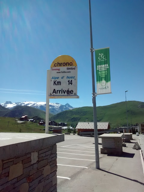
I climbed Alpe d'Huez on the first day of our holiday but turned right at round corner 4 so whilst I got to the top I did not follow the classic route ("Itiniere De Tour"). So I did it again and made the effort to get to the proper TdF finish rather than the top of the climb in the village.

Despite having climbed it once before and therefore knowing the route better I was slower everywhere that the first time I had climbed it - how could that be?

Here's the link: https://www.strava.com/activities/336010344


Here's me (after the 2nd attempt) at the top of Alpe d'Huez:


Wednesday, 1 July 2015

Col de Croix de Fer and Glandon

We're on holiday in the French Alps and on the first day tackled Col d'Ornon and the Alpe d'Huez. 

We were then equally ambitious and rode up to the Col de Croix de Fer and Col de Glandon from Bourg d'Oisons on the second day. I think we were a little over-optimistic and were basing everything on the previous days climbs. It turned out to be a monstrous climb - for me over 2 hours of climbing: https://www.strava.com/activities/335403446

The Route (there and back)

We started with a necessary warm up ride which was from the camp site, along the valley road (D1091) to the village of Allencon which marks the start of the climb. This is 2 zig zags up the face of a dam. We then turned left and rode along the side of the reservoir with a slight climb to the Musée EDF Hydrélec near Vaujany. This is the end of any respite though and after a few further hundred meters the road crosses a river bridge and the incline starts - straight up at 8-9%. The roads continues to meander on the left side of a valley, the gradient varying slightly but never dropping below 7% and often rising to 10%. This went on for some time and it took a couple of km to get into a rhythm. I needed the 30t on the rear again and was able to occasionally  use the 28t, and passed (slowly) a few other cyclists climbing the same route.

There was a tiny Hamlet (Aricol) after a few miles and then a slightly larger village - Le Rivier d'Allemenot. This did have a Eau Potable tap for those that needed water. About 1km later the road starts on a slight descent that suddenly turns into a 12% descent with 4 very sharp hairpin bends. This was not what I wanted to see as not only was there a descent but I could see the height that needed to be regained immediately afterwards. I rolled down the bends knowing that I was going to pay for it and after just a couple of minutes was back into the climb. However in this case it wasn't 7-8% but 10-12% for a good km. After the drop down this was really hard to get back into the rhythm again and I just had to slog it out. I really needed the 30t here. The climb then plateaued slightly before a left-right kink over another bridge and a climb back at the ore normal 7-8%.

At the next hairpin a Movistar liveried van was quite along way over the centre of the road but a few moments later I saw Nairo Quintana descending with a team mate. Probably a recce ride for this years Tour. I captured him on my Garmin Virb and here's a link:


Look at about 50 seconds - blink and you'll miss him! 

Here's a still:


After this the trees thinned out a bit and the climb continued. There were a few more hairpins and then a straighter section - all still at 7-8%. Gradually I could see the second dam ahead - the "Lac du Grand Maison" that feeds the  hydro-electric dam at Allencon. To get to the height of the dam and skirt the lake were another couple of hairpins and then then road skirted the valley with the lake to the right, and for the first time the gradient lessened to 4-6% - I was still in the 34t at the front but in the middle of the cassette at the rear - however I was passed by two people riding on the big ring! A little further on and the road lost some height - perhaps 50-100m over 1-2km so it was good to descend again and have a slight rest - although painful knowing I'd need to regain it again. The terrain here was also very open - short grass, rocky valley sides. The gradient eased up again to 7-8% again and it was a case of slogging it out. After a few more km I could see a building ahead and guessed it was the split between the Glandon and Croix de Fer summits. This was the case when I reached it and then saw the sign for Croix de Fer to 2.5km further on - not a great feeling as it seemed I should be there by now. These last few km were hard knowing there I was nearly there but not quite.

However finally I got to the top. My son was sitting at a table in front of the cafe having had an ice cream and coffee. It was great to reach the top - and have a coffee and ice cream. The views were fantastic, air clear and the sky blue.  We took some obligatory photos and then we rode down to the junction and back up to the summit of the Glandon

Here's some pictures:


My Son


Selfie


Looking North


The proof


The actual Croix de Fer


At the top of Col de Glandon
After this we rode back down again. Just like the day before the experience of descending for 20-30 minutes at a time is not something that I've done before, and with a bit more practice this was a better descent. The steep descent on the way up hurt as much on the way back though!