The Mighty "Giant of Provence" - Mont Ventoux. I had been lucky enough to persuade my wife (or perhaps lucky that she agreed!) to come on a cycling holiday with me (a cycling holiday for me - not for her!). We'd spent a week in the French Alps and were travelling to the Pyrenees. However Provence is on the way and we stopped in Bedoin so I could cycle the iconic Mont Ventoux.
All the words are true - as we approached in the car the giant mountain loomed ahead with nothing around it - it was huge and quite daunting in some respects. We parked in the town centre of Bedoin (for free as is nearly always the case in France). I got the bike out of the car, put the wheels back on and got changed in the clean public toilet and set off.
It was a really hot day and I'd not got going until 1pm. It was a nice start for less than a km through the town but then straight out into the open countryside and baking sun with temperatures over 30Deg C. For some reason (perhaps the heat) my heart rate was very high right from the start and I felt I had to slow down to pace myself over the whole climb. Before the climb proper (although the gradient was a few %) the road had been recently re-surfaced and I was accompanied by the sticky sound of tyres covered in tarmac sucking themselves onto the road. I took several km for this to wear off.
The climb proper started immediately after a left hand hairpin bend. It kicked up to 7-8% and in reality the climb stayed at this and then increased to between 8-10% for the next 12km up to the cafe at Chalet Reynard.
This first section to the cafe was very difficult. The heat was high and whilst there was shade from the scrubby trees this offered no relief. The km markers appeared regularly but a long way apart as I was managing only 6mph or so, but at least I could see progress being made.
There seemed to be no relenting in the gradient and it was a matter of making sure I managed my pace and kept hydrated properly with small but frequent sips of water. I was passed by 1 or 2 other cyclists and think I passed a couple of others in this stretch but it was slow and lonely progress.
I had hoped to switch between the 28 and 32 gear on the rear but right from the first corner I was in the 32 so I had no where else to go. I find that even if the 28 was a little too high changing up to it with the resultant cadence change for a few 100m was a good rest and gave further relief when I dropped back to the 32. For Ventoux I just had to grind up on the 32 all the way.
Finally Chalet Reynard appeared after about 90minutes and 12km of climbing and the relief was significant. The gradient eased for several hundred meters in front of the cafe and I got a real rest from this.
 |
| Chalet Reynard |
This section was completely tree less and thus without shade but the breeze (no more than this really) also made the conditions a lot more comfortable. I passed a few other people on this stretch and was able to spend about 50% of the time in the 28 and the rest in the 32. I had a gel and a cereal bar and felt reasonably good.
About 1.2km from the summit I could see the Tom Simpson memorial and swung out across the road to get a better view on my Virb:
 |
| The Tom Simpson Memorial |
I'd expected to see the traditional water bottles at the food but it was quite clean. I guess its periodically cleared up.
The gradient for the last km however rose and the last km was probably nearer 10% average compared to the previous 4or 5 km at a lower 6-7%. The fact that you could see the summit so close was both heartening and disheartening at the same time and it meant that the progress seemed really slow.
 |
| The "Top" - 1km to go |
 |
| The Final Hairpin |


I took the requisite pictures of the summit sign (and with me):


Here's an artistic picture of my bike looking over the summit to the east:

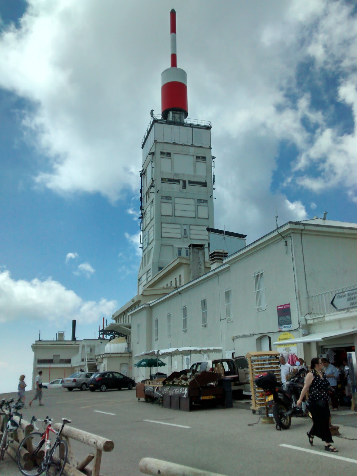
Here's the building at the top (an observatory I think):
And here's my bike with the sign:

It was everything I hoped and expected and the sense of achievement was enormous. It was certainly one of the hardest climbs I have done
Here's a video of the last 6-7miles of ascent:
Link to Strava Ride: https://www.strava.com/activities/626638731
Stats - The Strava HC Category climb from Bedoin to the summit: 12.4 miles, 5050ft of ascent at an average of 8%.
I managed 1:57:30 - an average speed of 6.4mph. (Compared to KoM Laurens ten Dam who climbed in 58:26 - an average speed of 12.8mph). My time put me 15836 out of 30521 so just below the 50% mark - I was very pleased with this.

I am not really a keen descender but the wide road and long gradients meant I could really put the hammer down. It was tremendous fun
Here's a video of 10 miles of descent towards Bedoin:
No comments:
Post a Comment